This page contains the map of Canary Islands which is in news. We have added important notes on it as well.
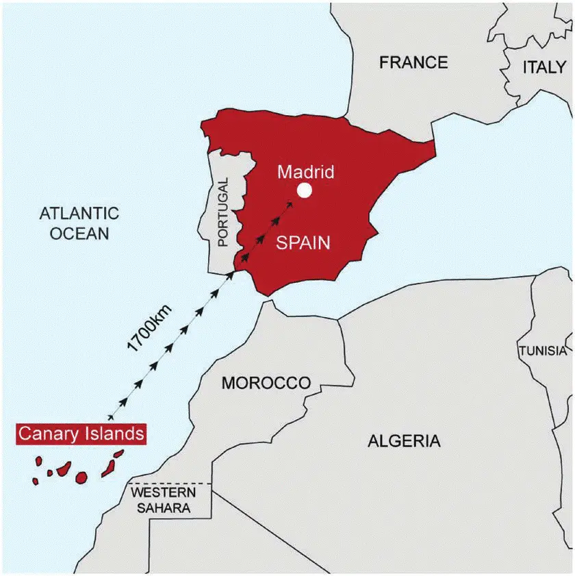
Rescue crews are searching for 48 migrants missing after a boat capsized near El Hierro, one of the Canary Islands. This could be the deadliest incident in 30 years of crossings from Africa to the Canary Islands.
About Canary Islands
- Location:
- Archipelago in the Atlantic Ocean, about 1,300 km south of mainland Spain and 115 km west of Morocco’s coast.
- Controlled by:
- Part of Spain.
- Origin:
- Formed by volcanic eruptions millions of years ago, creating a unique volcanic landscape.
- Climate:
- Subtropical with warm temperatures and minimal seasonal variation.
- Vegetation:
- Rich volcanic soil supports diverse vegetation, varying with elevation.
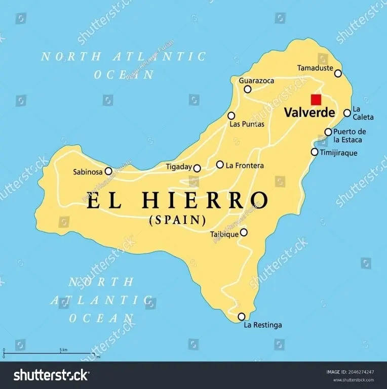
El Hierro Island
- Location:
- Southernmost and westernmost of the Canary Islands, near the African coast.
- Features:
- Known as the “Meridian Island”, with volcanic landscapes, rugged terrain, and a subtropical climate.
- Size:
- Second-smallest of the main Canary Islands, covering 268.51 square km.
- Capital & Population:
- Capital: Valverde. Population: ~11,659 (2023).